Biplane Point of View: Rio, Wisconsin

In the mid 1960s, Richard Bach captured a unique view of small towns as he barnstormed the Midwest in his 1929 Parks-Detroit P-2 biplane. He wove them into the narrative of Nothing by Chance, A Gypsy Pilot’s Adventures in Modern America, which I first read in 1969. About this time in 1966, down to their last few bucks for fuel and food, Bach and Stu MacPhearson, The Great American Flying Circus’s parachute jumper, landed at a small grass runway in Rio, Wisconsin, hoping to fly some passengers at $3 a head.

Rio-30

From the air, a silver water tower with black block letters named the town, which they later learned was pronounced RYE-oh. “Rio was a hill of trees rising out of the low hills of earth, with rooftops down beneath the green and church spires like holy missiles poised pure white in the sun,” Bach wrote. “Main Street stretched two blocks long, then fell back into trees and houses and farmland. A baseball game raged at the school field.”

Rio-33Flying two passengers, they had $6, $4 for red 80-octane avgas and $2 for dinner. Bach didn’t describe his path into town, but he said it was about a mile from the airport. On the way, they passed Al’s Sinclair, and they saw an A&W Root Beer stand not from it. The airport hasn’t moved since the Rio Flying Club built it 1959, so they must have walked south on Highway 16, then east on Rio St. to Lincoln Ave. There was no sign of Al’s Sinclair or A&W, but the business district is still two blocks long.

Dedicated in 1964, the post office, Rio, Wisconsin, 53960, is on the west corner or Rio and Lincoln. Across the street was an imposing two-story brick building. Over the door in the building’s flattened corner is a faded sign for the Econowash. The Hometown Café is several doors down from the post office. If Bach were here this late Sunday afternoon, he’d go hungry. The only café in town was shut and shuttered. Posted on the door, a sign said it opened every morning at 6 am, except Sunday when it started serving an hour later, and it closed everyday at 1 p.m., except on Monday, when it closed at 10:30 am.

Bach didn’t name the café, but he said it had five booths along one wall, and the waitress was Mary Lou. Closed blinds hid the Hometown Café’s seating arrangements. There were no other clues, and no one to ask. I tried Scott’s Rio Lanes on the second block of Lincoln Avenue, but it, too, was shut for the day, as was the Hometown Pharmacy across the street. LR’s Place was open, and so was Mark’s Market, but by then the architectural detains had captured my attention.

Rio-43

The market occupied Masonic Temple No. 12, built in 1902. The ornate blue cornice dated the City Hall to 1904. From the looks of wood panel fillers, I’d say that in its youth, it was home to the fire department. At Scott’s Rio Lanes, metal stations from “Portage Iron Works 1903” stood guard on either side of the door and provided support for the glass block wall.

Rio-51As it often does in many small towns, one compelling building summarizes history and progress, such as it is. In Rio, it was the Econowash. Above the door, the stone lintel proclaimed the entrance to First National Bank. Without a washer or dryer for folding table in sight through the dirty, smudged windows, it was clear that it ceased to be an Econowash some time ago. Standing back to get a better angle on the second floor windows, those rooms seemed equally empty.

Walking up Rio St. to the train tracks for a surrounding look-see, the bank was a substantial building. It would make a good brewery or brewpub. As it seemed to be the only empty building in the business district, it seems that there is still a fair amount of life in this village of 1,059 people (as of the 2010 census). When Bach visited, he said the population was 776. And given the friendly folks I’d met at the airport, I’ll be back to explore some more. (If you’re interested in the airport side of the story, see Barnstorming Rio, Wisconsin.)

Advertisement
Posted in Community, Food, Main Street | Tagged , , | 5 Comments

Waylaid by Colorful Creatures in Sebastopol

Day13-12Riding into any American small town always reminds me of home because the landscape is essentially the same. A few newer, larger houses of usually nondescript architecture stand guard on the outskirts of town. As you approach the town center, the homes that line the thoroughfare grow smaller, older, and start to share a tidier structural style. In small towns where a front porch spans a home’s face, when people sitting on them return my wave, the street smiles.

Passing through such small towns there are few reason to stop beyond the need for gas, food, or lodging. It is enough to admire its particular landscape and wonder if its residents see and appreciate their hometown as I do. There are exceptions, of course, like Sebastopol, California.

North of San Francisco Bay, roughly 7,500 people reside in this tidy town surrounded by wine country and equidistant from the Pacific Coast and Santa Rosa. After turning right at the Santa Monica end of Route 66, Ed and I were following the coast roads to Seattle. We over-nighted in Santa Rosa on August 11, 2016, because the reasonably priced Hotel Azura was half-mile walk from the Russian River Brewing Company.

Day13-15Heading to Bodega Bay the next morning, State Highway 12 led us out of Santa Rosa. In Sebastopol, CA 12 abruptly ended at Main Street. Unsure of our route, instead of continuing westward on Bodega Avenue, we turned right on North Main Street. GPS called out our error and told us to turn left at Florence Avenue and return to Bodega Avenue, which became Bodega Highway at the western city limits.

As we turned onto Florence Avenue, a towering tan square-pants creature with a mailbox nose standing on a blue and yellow circus drum. His right hand held a fire red pedal car in its right hand, waved at us from behind the sidewalk. Slowing to take a long head-turning look, I have the homeowner bonus points for a courageous character of individual expression. When my eyes bounced forward, there stood a bright blue creature in another yard.

Day13-8My curiosity screamed STOP!

Wandering up and down both sides of Florence Avenue revealed an unmistakable family gathering of welded creatures and creations. What was most maddening was the outdoor absence of a resident who might explain this extraordinary gallery of neighborliness. Crossing the street to meet the creatures who lived there I saw an old fire alarm box, whose nationwide extinction preceded pay phones by a decade or two. “Please Take A Pamphlet,” it urged in white hand-painted letters.

An arrow pointed the way in to an eight-panel booklet that folded down to 4.25-by-5.5-inches. “Patrick Amiot” it read, “Urban Folk Art.” On the back, it said, “Patrick Amiot and Brigitte Laurent live and work in Sebastopol, California. Their junk art and wall reliefs are a collaborative effort of ideas and talents. Jointly conceived; Patrick sculpts and Brigitte paints.” It said nothing of this unique neighborhood gallery.

Day13-10Amiot’s website showed me more of his work and told me about how he creates it. But it never explained how his sculptural relations came to live in front yards up and down Florence Avenue. I assumed that his studio was the house with the fire alarm box pamphlet holder.

This is as close as his website came to an explanation. Turning to urban folk art for fun, “he created and installed a giant fisherman made from a water heater in his front yard, and received an unexpected reaction—his neighbors want to see more.”

Day13-13

An article in the San Francisco Chronicle, “There’s Art on Our Lawn,” provided a few more details. The other members of the sculptural family are “on loan” to his neighbors. But I wonder, who approached whom about these loans? The reporter interviewed one of them, Jude Kreissman. A teacher, she said of Amiot and Laurent: “We’re great admirers of their work and their life. We love having them as neighbors as much as having the art in our yard.”

In the end, neighborliness is what matters most, which is why knowing the names of the people who live next door, if not all the way down the block, is something else that defines the character of a small town. And in Sebastopol, on Florence Avenue at least, they have opened their hearts—and yards—to creations and creatures that are a joy to meet and behold.

Posted in Art, Community, Main Street, Motorcycle | Tagged , , , | 1 Comment

Religious Light & Reality at National Parks

Snuggled up indoors, the polar vortex condensed home humidity into narrow frozen frames at the bottom corners of our new double-pane windows. Watching sunset’s pastel colors play across a crystalline canvas stirred warm weather memories. No matter the season or location, the low-angle light of the golden hour saturates the scene with emotion. This religious light illuminates documentaries and welcome videos at national park visitor centers.

Day8-50These presentations take visitors to places antipodal to what’s outside the theater. The unpopulated wilderness, whose only sights and sounds are majestic trees or mountains, chirping birds, and scampering four-legged critters, exists only on the screen. At many parks—Yellowstone and the Grand Canyon come to mind—the theater is in a vast visitors strip mall. Trinket-filled shops border a corridor filled with people struggling like spawning salmon.

Time doesn’t transfer from the saturated solitude recorded during that golden hour at sunrise and sunset. Most of us visit the parks in the harsh vertical light of midday. So a sea of faces, their backs turned to the steam geyser or river-carved canyon, obscures your view. A squadron of reconnaissance butterflies flitter above them, selfie-sticked phones that see little more than other faces doing the same thing.

Bike-130

Yellowstone National Park introduced me to this religious light disconnect in 2013, and it tempered my anticipation of our Grand Canyon stop as Ed and I two-wheeled Route 66 in 2016. I expected the crowds, but the strip malls that stood like stark movie sets along the road that led to the park surprised me. All the nationwide name brands stood shoulder to shoulder.

After a long, slow walk in the line of traffic, I got a surprise at the tollbooth. Unhelmeting my sweaty head, the ranger asked for $25, “unless you’re 62…” Interrupting her with the required age, she said, “Let me rephrase that, it will be $10.” Handing me a clipboard, she said I should sign the plastic wallet card with the fine-point Sharpie after completing the form under it.

While I was writing and signing, she explained that the National Parks and Federal Recreational Lands Pass is a get-in-free card good for however many years remain for U.S. citizens and legal residents who are 62 or older. That includes the occupants of a “single noncommercial vehicle OR one motorcycle.” Ed had to pay $25. The ranger said he could return in five weeks, when he turned 62.

Day8-52The Journey of Wonder basked in religious light. Leaving the darkened room, the wonder that embraced me was not the “young canyon’s exposure of rock half as old at the Earth, about 4 billion years,” but the diversity of visitors. During the short walk to the Mather Point lookout, I heard Spanish, Italian, French, German, Portuguese, Chinese, Japanese, and a few others I couldn’t put an ear on.

Heading out of the park late in the day, after a long hike across vast parking lots, we passed a long line of cars heading into the park. Hot, tired, and thirsty, we didn’t turn around. The motel clerk confirmed our assumption that the canyon overlooks were doubly dense packed with people seeking spectral emotion they’d seen in the welcome center film.

Day16-34There are exceptions to the strip mall welcome centers. Isle Royale National Park has tidy rustic facilities at each end of the park that are not typically crowded. But it is an island in Lake Superior 6 hours north-northwest of Houghton, Michigan. Crater Lake National Park is another. Ed and I visited after turning north at the end of Route 66. It became my favorite mainland park, and not only because my new parks pass got me in free.

Crater Lake is more private, more personal. Working our way up a twisty turny two-lane road, we stopped at Annie’s Falls, a turnout before the visitors center. A man wearing a Great Lakes sweatshirt, “No Salt, No Sharks,” walked up, nodded at my bike, and said I was a long way from home. From Grand Rapids, Michigan, Bernie rode a Triumph Trophy, but his wife, Bonnie, didn’t do motorcycles, so they were four-wheeling to see their son in Portland, Oregon.

Day16-15We met them again at Crater Lake’s visitor center, a tidy rustic structure with just an alcove of trinkets. Out front, an older female ranger was giving the oath to a young girl who’d just finished the junior ranger program. Inside, the 22-minute movie, filmed with its fair share of religious light, indirectly explained why Crater Lake would never become a Grand Canyon.

The lake’s watershed is a unique, introverted environment. With no streams flowing in or out of it, its 5 trillion gallons of the world’s purest water comes from snowmelt alone. In 1997, the park lowered a Secchi Disk into the 1,943-foot abyss; it disappeared at 143 feet. Sunlight feeds moss that grows between 100 and 400 feet. The park gets, on average, 44 feet of snow every winter, and we saw patches of it during our August circumnavigation of the cone.

Day16-47

Instead of following signs that move herds along concrete causeways, Ed and I wheeled our way along two-lane road with lovely twists and turns. We reached most of the viewpoints with short hikes from small parking areas. At the crater’s rim, even at midday, the views came closer to the video vistas than at any other mainland park. The small handfuls of visitors at each overlook took photos of the lake, not themselves.

At the Phantom Ship overlook, I met a grandmother who was following her son and his family in her car, and she offered me a cookie. Joining us, the son recommended the molasses cookie, “It’s to die for!” He was right. I got one for Ed as well. The cookies were, like the family, normal sized. Grandma said her son was 6-foot-10. His wife looked to be 6-foot or better, and their kids, a boy and girl in their teens, looked like they would soon top their parents.

When I returned home, the September National G told a depressing tale of the commercial threats facing one of our stops in “Grand Canyon for Sale.” Congress made Crater Lake a national park in 1902. This protected topography, home to some of the last old growth trees in the Pacific Northwest, seems safe from development, but one should never underestimate the ingenuity driven by avarice of developers—and their investors.

Posted in Motorcycle, National Parks, Travel | Tagged , , , , | Leave a comment

Paddling to the Milky Way at Voyageurs National Park

Paddle Voyageurs National Park 2018

An hour before a cloudless September sunset, Kyle and I pitched our tents at the Ash River Campground and waited for his brother, Braden, so we could begin our five-day, father-son adventure at Voyageurs National Park. A Minnesota DNR pocket park across a gravel road from its eponymous waterway, you self-register for the eight first-come, first-serve sites. Three bucks short of the $14 fee, we hoped Braden had $3, so we wouldn’t have to sacrifice a $20.

NOAA weather radio warned of coming rain. Pitched on Site 8’s level spots, our tents formed an obtuse triangle with two trees suitably spaced for Braden’s hammock. A 28-year old mechanical engineer, Kyle traveled from St. Louis to join me in Omro. Braden, a 31-year-old ICU nurse, was on his way from Kansas City, where he’d settled with his family after five years with the Navy.

Paddle Voyageurs National Park 2018When Kyle wandered into the gloaming in search of a cell signal, I slouched on the picnic table and stared at the celestial hi-def big screen framed by the surrounding trees. A loon warbled in the deepening darkness and the Milky Way came into focus. I’d last seen the Milky Way in 2006, the year Braden graduated from high school. We three were camping in the wilds of south-central Missouri to raft our way down the Niangua River.

That was the last adventure until now. We made our first big trip in 2002, a five-day guided tour of the Apostle Islands that introduced us to sea kayaks and Lake Superior. We saw the Milky Way there, too.

Annual adventures seemed the best way for me, a noncustodial father, to spend time with my sons that built lasting memories. They sustained us through their college years and the inauguration of their careers. We gathered at Braden’s new home for Thanksgiving 2017. Marking the commencement of my 64th year the next day, we recalled the highlights of our adventures, and we immediately agreed that it was time to resume them.

Paddle Voyageurs National Park 2018Since we had the boats, it must be a kayak adventure. I’d built an 18-foot CLC Chesapeake the year after the Apostle trip, and Kyle would paddle the 17-footer I built for my wife several years ago. Braden has a 17.5-foot Pygmy Coho Hi that he built while stationed at the Camp Jejune Marine Base Hospital in North Carolina.

We considered an Apostles redux but then came to our senses. With wetsuit water temps and robust reactions to weather, prudent, inexperienced Lake Superior paddlers opt for experienced guidance. This adventure had to be DIY, flexible, and affordable. But where? Braden remembered his Eagle Scout trip to the Boundary Waters Canoe Area Wilderness, and then he remembered all the portages. Sea kayaks don’t portage well.

Recalling a seminar at Canoecopia, Madison’s annual paddling extravaganza, I suggested Voyageurs National Park. Snuggled against the Canadian border between Ely and International Falls, the speaker said it was like the Boundary Waters without portaging, and a boat is the only way to reach campsites scattered among its roughly 500 islands.

Wanting to avoid bugs and people, we committed to September 2018, after Labor Day. Appointed plan master, my research was now becoming reality. Stumbling into a dark ditch on his way back to camp, Kyle cursed. He reported a no-bar cell signal, but he did somehow get a Snap Chat from his girlfriend.

Staring at the stars, we hoped that Braden would have $3. He arrived at 2115 and reached for his wallet. As he hung his hammock, the clouds steadily thickened like new sponges tossed into a star-filled pond. Mother Nature waited until sleep found us before squeezing the rain out of them.

Planning & Preparation

By Google results, Voyagers National Park is not very popular with kayakers. Fishermen and house boaters, yes. Paddlers? Not so much. The only thing close to a current guidebook I found was Steve Parrish’s 2015 report at Central Iowa Paddlers. But it got me started; that’s how we ended up at the Ash River Campground.

Paddle Voyageurs National Park 2018Looking at the park’s website map, most of Voyageurs National Park’s 218,200 acres are covered by interconnected lakes, Rainy, Kabetogama, Namakan, Sand Point, and Crane. Three visitors centers are the primary access points. The Rainy Lake center, 12 miles east of International Falls, anchors the park’s western border, and the Crane Lake Ranger Station is the eastern portal.

On the park’s south side are two seasonal centers, staffed by volunteers from late May through late September. Situated in the middle of the lake’s southern shore is the Kabetogama center. To the east, in the narrow passage that leads to Namakan Lake, is the Ash River center. It was our logical starting point. From there we could paddle to either lake. With the campsite map showing a surfeit of nearby islands, we would paddle east into Namakan.

Looking at my thumbprint-smudged monitor, I needed a better way to measure the distance between the island campsites. The measurement tool on BaseCamp, Garmin’s PC planner, would work if I had TOPO 24K maps that depict terrain details at 1:24,000 scale and include searchable points of interest, including campsites. My old handheld GPS couldn’t swallow the map’s microSD card, so I rationally replaced it with a waterproof Garmin eTrex Touch 35t, which came with a 100K topographic base map, compass, and barometric altimeter.

A Fox River paddle dashed my hopes that the new GPS’s turn-by-turn road and trail directions would extend to waterways. With the GPS needle pointing directly at our destination, when an island was in our way we’d have to figure the turns on a map. National Geographic’s Trails Illustrated Topographic Map on waterproof, tear-resistant paper depicts topographic details and identifies all of VNP’s navigation buoys and campsites.

Paddle Voyageurs National Park 2018Our Namakan adventure would be a pinball paddle. Focusing on our daily distances, I should have paid more attention to each campsite’s amenities before selecting our destinations. Every island site has a privy, picnic table, critter-proof food locker, tent pads, and fire ring. After plotting our route, I visited the photo gallery of the Namakan Lake campsites. These included an important, specific amenity—the landing. Three of my first four choices had docks, invitations for getting wet when getting in or out of a kayak.

Starting over, I went a step further and identified all of the sand or pebble beach landings on my NatGeo map. Besides simplifying my redo, it gave me one-glance peace of mind should we need rapid refuge from wet and sparkly weather. Next, I downloaded and similarly edited the list of campsite GPS waypoints.

When shoreline property today is private, Voyageurs National Park is as close as we can get to exploring a watery wilderness as the park’s namesakes once did. Claiming campsite is not first-come, first-served. With a $10 fee, you must reserve each one at recreation.gov for $20 a night. A coded calendar shows the availability of each one. With a few clicks, a credit card, and some related information, you’re done after reading and accepting VNP’s rules and regs.

Paddle Voyageurs National Park 2018Emails confirmed our campsite reservation. Printing the Visitor’s Permit limits the refund options. After consulting the long-term forecast, which suggested several days with increased chances for rain and temperatures in the seasonal ballpark, lows in the 40s and highs in the 60s, I clicked “Print” four days before our registered start.

In an email confirming our adventure, I sent a float plan for the boys to share with their mates. It said when and where we planned to be and included identifying details, such as our ages and the colors of our boats and PFDs. Numbers to call for search parties if we didn’t communicate by our expected return to cell service followed.

We promised to try daily check-ins, but we repeated the park’s website warning of limited or no cell service. Finally, we proved our preparedness with a list: VHF marine band radios (the park monitors emergency channel 16), signal mirrors and flashing headlamps, first-aid kits, fire starting materials, water filters, and week’s food for a four-night trip.

Getting Underway

Paddle Voyageurs National Park 2018

With no-bar signals, we turned off our phones to save the batteries. I forgot my weather-station carabineer watch, and Kyle’s $11 “wonder watch” didn’t have an alarm, so our circadian rhythms would dictate our days. Up first, thanks to my bladder, I enjoyed a beaker of hot Starbucks Via on a cool misty morning. Kyle’s tent snored and Braden was a silent hammock sausage. Halfway through my second coffee, the boys stirred.

Paddle Voyageurs National Park 2018Nosing to a stop at the Ash River Visitors Center, rainwater sloshed in the kayak cockpits. Climbing the stairs to the rustic brown structure, I had to duck through the doorway of what once was Meadwood Lodge. The anteroom displayed books, souvenirs, and a rack of National Geographic maps. In the next room, its walls covered with storyboards of park history, a tidy fire crackled in the fireplace.

At the cash counter, a volunteer said there was no check in, “Just hang your Visitor’s Permit on the bear box.” The permit was a Trip Itinerary that listed how many people could stay at the reserved site on the given day. “Mon Sep 10 2018-Tue Sept 11 2018 (1 Night) Namakan Island South-N63 Group Size: 3.”

Boat ramps with parking lots bookend the visitor center; to the east is a concrete incline for powerboats, and to the west, we portaged our boats (after dumping their collected rainwater) down a tree-lined trail to a low dock and narrow pebble beach. Then we began the dry-bag shuttle run.

Paddle Voyageurs National Park 2018Having practiced a load out in Omro, Kyle and I finished first. Braden moved a small mountain of small dry bags that he fed into the open deck hatches like a momma bird. As we geared up, he unsuccessfully searched for his spray skirt, which covers the gap between his torso and cockpit coaming. If the weather behaved, he’d stay dry.

BaseCamp measured our first leg at 6 miles. At 1130 GPS time, we paddled on calm water for Namakan Island. Rounding Portage Beach, we aimed for the green dot on the watery horizon, Buoy C29 according to the map. Passing it, we banked southeast toward the next green dot, Buoy C27.

Going two-for-two calmed my navigation anxiety. Crossing the mouth of Old Dutch Bay, we turned northward toward Red Buoy 26, past Ziski Island on the left, and on to Green Buoy 23 and Blind Indian Narrows. Threading our way between Sweetnose Island and an unnamed hump of trees, we passed Red Buoy 22 and beached at Cemetery Island for lunch.

Paddle Voyageurs National Park 2018Knuckles deep in the trail mix bag we watched a bald eagle wing and wheel, searching for its lunch. We’d seen maybe a dozen eagles so far, and we wanted to see at least one catch its meal. Braden, who’d bought a Minnesota fishing license, followed suit as we paddled on. After sprinting ahead he’d cast away while we caught up. His luck was no better than the eagle’s.

Just off Sexton Island, we rounded Red Buoy 20. Passing Stevens Island, the GPS pointed unobstructed at Namakan Island Campsite N63. We skidded into the sand beach at 1410. After sitting for so long, my unsteady exit landed me butt first in the water, earning a giggly round of applause. The GPS reported a 6.2-mile paddle in two hours, with a total trip time of more than 2.5 hours. I didn’t think lunch lasted that long.

Paddle Voyageurs National Park 2018With the sun growing warmer through the dissipating clouds, we hung our tents to dry before pitching them. While sitting at the shoreline, pumping water through my filter, Kyle muttered “shit!” Anxious to use his new Steripen UV water purifier…he’d forgotten batteries. Muttering, he handed me his water bottle and wandered inland to explore.

While gravity pulled water through the filter between his water bags, Braden worked his fishing pole. He shortly had words with an aggressive northern pike that stole his lure and leader. Replacing them, he caught the same fish again, the pilfered tackle dangling from its mouth. This time he got it on the bank, but it flopped back to the lake before he could mete out justice.

Our tent pads were maybe 12-feet square, outlined with stacked timbers. Filled with sand, they were level, lump free, and well drained. Braden took up residence in the trees behind Kyle’s tent. There was enough room in the boys’s bear box for all their dry bags, including Braden’s fifth of Jamison’s and 12-pack of Coke cans. Where does he put all of this stuff in his boat?

Paddle Voyageurs National Park 2018Made of diamond steel mesh covered in brown vinyl, the picnic table’s benches are cheese grater comfortable. I didn’t immediately notice this because I was listening to the water softly purl the pebbled beach like a lazy cat lapping milk. Muted by distance, an outboard motor humbuzzzed. We’d seen one distant houseboat and a few anglers; those who passed closely respected of our paddle-powered craft.

Kyle emerged from the woods bearing an armload of fallen deadwood. The frustrated fish fighter followed him back into the woods. As Eagle Scouts, they came prepared for campfires. Braden packed a folding saw and Kyle bought a big knife for shaving kindling. Instead of using some of his stove’s white gas, Braden got things started with Vaseline soaked cotton ball.

Paddle Voyageurs National Park 2018Kyle ate commercial camp meals. Braden and I made our own dehydrated delights. Because I didn’t want to pack out the leftovers, I ate on oversized portion of zippy spaghetti. I might have been okay if Braden hadn’t brought appetizers, addictively delicious bags of backstrap deer jerky and dried kiwi.

With the fire crackling into a cloud free sky, we quietly probed the Milky Way. We hoped the weather would hold because Braden said the forecast predicted their first sight of the northern lights for Thursday

Wind & Waves

Paddle Voyageurs National Park 2018

Before opening my eyes, I listened to the morning sounds. Fish splashed and distant anglers buzzed softly to their secret spots. Chirps and peeps surrounded me and an undecipherable fluttering rustled the leaves next to my tent. What kind of critter was playing with my imagination?

Motivated by micturition, I crawled out and saw the sound. Smaller than my clenched fist, a short-winged brown bird darted in and out of the shrubbery. Above it, the trees were dancing in a brisk breeze under a cloudless sunny sky. Without a spray skirt, today was going to suck for Braden.

With a south wind blowing 15 mph, at 1123 we nosed into a 12-inch chop and turned eastward for Pike Bay and Campsite N31. Braden yelped with bigger cold lap splashes and periodically sponged his cockpit dry. With the boats wanting to weathervane, we clawed our way east with slow, asymmetric strokes. We beached on the lee side of McManus Island for lunch. The GPS said we’d covered 2.2 miles in 2.5 hours, an average of .9 mph.

Paddle Voyageurs National Park 2018This was Kyle’s fault. Yesterday he’d boasted that his first paddle since 2002 had been too easy. He didn’t think so during lunch. It was going to be long 6-mile day. As we pushed off the beach, Braden assured himself that he’d never again forget his spray skirt.

Paddling through the channel between McManus and Sheen islands, we crawled along the south sides of the Wolf Pack, Fox, and Jug islands and clawed our way past Randolph Bay and Smugglers Point. With the wind, we were within spitting distance of the Canadian border.

We rounded the point that forms Pike Bay around 1400 and found placid water gently massaging a wide sand beach. Flopping out of our cockpits, we rested on sun-warmed sand caressed by a whispering wind. A weightlifter, Kyle worried that our asymmetric marathon might have made his right trapezoid larger than his left. I was wondering if my supply of cigars and Tullamore DEW would allow a twofer, one now, and another with our campfire.

Paddle Voyageurs National Park 2018While Kyle napped on the sand, I waded into Pike Bay for a bath and Braden went to hang his hammock. In the middle of my refreshing soap-free scrub, Braden slid back into his boat with his fishing pole. “I forgot my tree straps,” he grumped. He improvised a paracord replacement, and I said we could stop for them on our way back the day after tomorrow.

“If I can’t catch a fish in 20 casts, there are no fish here,” Braden said as he drove into the beach. Roused by Braden’s return, Kyle waded in for a bay bath, then joined him for a firewood forage. Facing northeast, trees blocked our sunset view, but the Milky Way was majestic. Was this a good omen for Thursday’s aurora borealis? Either way, I gave silent thanks for this opportunity to know the men my sons had become.

Paddle Voyageurs National Park 2018Spanglers are an unpretentious lot, and tact is a recessive gene, so our unfiltered communication has always been clear and concise. They dismissed my worries about being a noncustodial father. Never did they feel abandoned or ignored. “You were always honest, open, and straightforward,” said Kyle. No one had to guess where anyone stood, said Braden, who is employing this himself as the father of a blended family of four boys.

Kyle parroted my tattoo warning when they were in high school: “If you come home with ink, I’ll remove it with a belt sander.” Nodding agreement, I asked his point. “You also said that when we turned 18, we could make—and be responsible for—our decisions.” The only thing I’d ever said about his shoulder and half sleeve were my compliments to the artist and questions about the meanings of the Japanese-inspired scenes.

Our conversation faded as the fire became slumbering embers and the trees started to dance in the wind. NOAA Weather radio said storms were in the offing.

Rain & Recovery

Paddle Voyageurs National Park 2018We awoke early to overcast skies, a decreasing breeze, and a good forecast: partly sunny, 70 degrees, a light breeze, and a small chance of scattered showers. We breakfasted, broke camp, and paddled away from our nicest campsite of the trip at 0955.

An easy 5-mile paddle to Junction Bay and Campsite N14 revealed a green-season navigation challenge. It is nearly impossible to tell where one forested island ends and the one behind it begins. Instead of the shorter route to the south, that’s why we paddled the long way around Wolf Pack Islands, which looked like they were connected to Sheen Point.

Paddle Voyageurs National Park 2018The map showed a gap between Sheen Point and McManus Island. All we saw was a shoulder-to-shoulder line of trees standing behind an unbroken screen of reeds. With our early start and a sunshine sky, we’d have plenty of time to take the long way round, if needed. We didn’t need. There was a gap in the reeds one kayak wide.

Confusion reigned when the GPS pointed at a rocky point topped by small brown sign for Campsite N14. Where was the beach? Rounding the knobby point, Kyle warned me about a submerged rock just before I went aground. Not 15 feet ahead of me, rustic stairs climbed the hill from a narrow pebble beach. It took me a few minutes to skootch myself off the rock, and the boys enjoyed the show from shore. I joined them just before noon.

During lunch, I looked at the map, checked the GPS, pointed at Namakan Island, and told Braden that his tree straps were 2.6-miles thataway. Kyle said he’d go with him. Suffering from a poor night’s sleep and with the sniffles working on my sinuses, I promised to keep an eye on camp.

Paddle Voyageurs National Park 2018

Before they launched, Braden found his spray skirt. Showing off his PFD, he explained every strap and pocket. When I asked what was in a right-side pocket, he said “nothing.” It didn’t look it, so I tugged the zipper and freed a wadded ball of fabric. Without a word, he gave me a hug.

Radio equipped and following the GPS, the boys paddled away under sunny skies. As they diminished in size, the trip’s first mosquitoes buzzed into camp. Then saturated clouds slid overhead, and I strung up my 10-foot tarp over the picnic table before they dripped on me.

Paddle Voyageurs National Park 2018Returning with Braden’s tree straps, they said they didn’t see any rain, or campers. By the map, we’d passed many campsites, but they are so discrete that we only saw one, a group site with tents and tarps. The campers must have been fishing because the dock was boatless.

Shortly after their return, a 15 mph south wind whipped whitecaps into the water. We hauled the boats off the beach before the approaching thunderstorm further churned the water and then took refuge under the tarp. Braden and I padded the cheese grater bench with dry bags. Kyle sat on his weightlifter-thick glutes.

Reaching into his Harry Potter dry bag, Braden pulled out Ziplocs full of deer jerky and kiwi. There was little left after the storm blew through giving our campsite an excellent Wednesday sunset view. As our campfire replaced the sun, we shared hope for a cloudless stage for Thursday’s northern lights.

Paddle Voyageurs National Park 2018

Clouds & Congestion

Paddle Voyageurs National Park 2018We had a short, quick paddle to Campsite N44, Williams Island South. Heading west, the wind increased past Postage Island, but the weathervane worked for us as we followed the shoreline until Williams Island stood before us. We covered the 3.8 miles in 1.3 hours, arriving on another narrow pebble beach at 1040.

My sniffles had matured, so I took a nap while the boys foraged for firewood. Unsure if sleep found me, I felt better when I crawled out of my tent on sore shoulders. I massaged them with memory’s balm of gently bobbing with my boys on the lee side of an island, watching eagles look for lunch. If we see the aurora borealis tonight, the only fantasy so far unfilled is seeing an eagle snag its supper from the lake.

Paddle Voyageurs National Park 2018Braden had better luck than the eagles; he caught a small mouth bass. Trying for a second, he changed lures and snagged a northern pike. With Braden’s short pole, Kyle had no such luck. From his magic dry bags, Braden withdrew fillet knife, breading, and cooking oil and prepared a delicious appetizer.

The clouds started moving in after dinner. While Kyle was preparing to light the evening’s entertainment, two loons paddled silently by in water behind him. With a tufted gray comforter of clouds hiding any glimmer of the northern lights, I turned in early.

Dead Man Paddling

Our safe return to the Visitors Center is proof that VNP is a benign but worthwhile DIY adventure. Its forested confines moderate Mother Nature’s moods, the campsites are excellent, and at no point did we get unintentionally wet. This allowed me, with my cold near its turgid redline, to paddle on pure muscle memory. We launched at 0800. Braden and Kyle led the way and set an endurable pace that covered 5.3 miles in about 2 hours.

Rather than shuttle-run our gear to the parking lot, the boys toted the loaded boats up the path. On the road, just before Braden’s exit for Kansas City, we stopped in Virginia, Minnesota, for lunch at Adventures Restaurant and Pub. Spending time again under the Milky Way was good, we agreed. But we still wanted to see the northern lights. Returning was our only logical solution. Besides, there was so much more to explore.

Posted in Camping, Kayaking, National Parks, Travel | Tagged , , , | 1 Comment

Dee Wright Observatory: An Interactive Rock Pile

Day22-30Heading east, the McKenzie Pass-Santiam Pass National Scenic Byway is an asphalt scar that wends its way over the Cascade Mountains and through the Willamette National Forest that surrounds a lava dome like male pattern baldness. Deep in the Cascade’s rain shadow, there are a few trees, isolated strays like the lonely strands my wife prunes quarterly, one by one, with scissors when doing my cranial yard work. As the landscape begins to flatten, I pass a sign pointing to a trailhead for the Pacific Crest Trail. Scanning the terrain to the limit of my head’s rotation, I strike this trail from my backpacking to-do list.

Ahead is a conical bump in the lava field that flows to the horizon. As my approach brings its details into focus, it’s clearly manmade, and people are crossing the road from the parking lot and climbing to its summit on a spiraling stairway. Made of the same volcanic rock that surrounds me, this structure, in the middle of nowhere, was clearly created by the Civilian Conservation Corps during the Depression of the 1930s. Downshifting, I leaned into a parking space and eagerly dismounted.

A brown US Forest Service sign proclaims that the Dee Wright Observatory is part of the Willamette National Forest. Mountains surround the empty terrain at almost every point on the compass by mountains; the absence of light pollution would reveal a celestial Milky Way majesty. And it would make riding at night a bit more interesting than I would prefer.

Day22-43Ascending the spiral stairway’s uneven treads of lava leveled to the best of the CCC’s ability, before attaining the summit an entryway leads to the observatory’s shadowed interior. Therein, a bronze plaque confirmed the CCC construction and corrected my assumption of what it observed. “To the south are the Three Sisters, bearing 17 glaciers, 2,257-acres in extent, and represent the largest glaciers to far south in the United States.”

Small openings dotted the interior’s circular walls at seemingly irregular intervals. Crossing to the closest one, a carved stone said the opening framed the North Sister. Next to it were similar frames for the Middle and South Sisters. While the mountains remain unchanged in the observatory’s explanatory apertures, 15 miles west of the Sisters on State Route 242, all that remains of the glaciers is a small, snowy white yarmulke.

After meeting the Three Sisters, I stepped up to each aperture for an introduction to Mount Washington and Mount Jefferson, and 78.5 miles to the north, the snow-capped Mount Hood. Coming full circle, the plaque taught me that the CCC built the observatory at the high point of the surrounding lava field that also provided the building materials. The corps completed the observatory in 1935 and named it in honor of the crew’s supervisor, who died the year before they completed it.

Climbing to the observatory’s summit, like a button on a rocky ball cap, a brass compass card names the geographic features, gives their distances and elevations, and offers a relative bearing of sight. In addition to the mountains, it includes the Belknap Crater, the source of the lava that flowed forth 11,700 years ago. A shield volcano, the lava accumulated in a 65-square-mile sheet with a low profile, like Captain America’s shield, but without the patriotic decorations.

Around me, couples and kids were in perpetual motion, pointing and sharing new knowledge. One youngster pointed her arm along the bearing to Three Fingered Jack; her companion wondered if there was a window for it below, and then they raced down the stairs to find the answer. If there were ever an award for a completely green, interactive exhibit that concisely conveyed information—and required exertion beyond pressing a button—Dee Wright and this Civilian Conservation Crew would surely win.

Day22-40

Connected to the Internet at my overnight waypoint I tried, unsuccessfully, to learn the name of the observatory’s designer. But my search wasn’t fruitless. NASA trained Apollo astronauts at the lava field in 1964. And even though I was passing through in August, the scenic byway had just begun its 2016 season. Despite the Cascades rain shadow, the Oregon Department of Transportation often can’t clear the pass until the end of June. They close the route in early autumn, before the snow season begins.

Scrolling through the day’s images, I remembered the feel of the cool air and sun’s warmth. The crystalline sky more clearly focused in memory the surrounding sights than any photograph could, regardless of its gigapixels. It was an encounter beyond the visual dynamic range. It was sensory imprinting, sight and sound and touch working in concert to build a memory far more durable than proposed by a high-def computer screen in a climate-controlled box. What began as a leg-stretching investigation of an unexpected structure offered the reward of discovery and introspection.

Posted in Civilian Conservation Corps, Motorcycle, Travel | Tagged , , , | 1 Comment

Shunpike Customs & Currency

Day 11-22There were few essential documents needed for Shunpike Canada. First was a passport. 9/11 terminated the convenience of crossing the border both ways with just the second required document, a driver’s license, which was the only proof of citizenship needed for my inaugural visit to Canada in 1981. Everything else, from customs at the border, insurance, and paying my way with money denominated with terms, and mobile communication were unknowns seeking anxious enlightenment.

Explaining my journey, my insurance agent said I was covered, that most vehicle insurance travels well north of the border. All I needed was my proof of insurance card. Expecting an injury-free adventure, I didn’t think about my health insurance until I’d returned. Fortunately, my expectations were fulfilled.

Online enlightenment about currency exchange was not clear cut. Many businesses just across the border on both sides accept the other nation’s currency. But this is not a nationwide courtesy north or south. After wading through a lot of conflicting advice, the consensus favored ATM withdrawals over currency exchange at a border bank because it’s more convenient and often has a better exchange rate.

What mattered more were the fees. There’s always a fee. As always, the question is how much? Being persistently frugal (or, depending on your point of view, stubbornly cheap), I requested and read the fine print provided by my bank and credit card companies, VISA and Discover. Because I hate monetary surprises, I included my mobile communicator, Verizon.

The good news is that my iPhone and VISA credit card would work anywhere I went in Canada. To communicate, beyond getting at least one bar of service, I would have to buy an international plan or a $5 TravelPass that drew on my existing talk, text, and data plan. The latter was the more economical option, and I really didn’t have to “buy” it; Verizon added the daily fee to my account every day I used my phone in Canada. Not using my phone wasn’t an option because my wife expected texts reporting my daily OTR (on the road) times and Arrival updates that informed her of our location. Every other day or so I’d call to share the more details. 

Canada accepted my MasterCard ATM and VISA universally, so it was no surprise that this convenience came with a fee. In addition to ATM fees for getting Canadian cash, my bank imposed a fee “equal to 3 percent of the amount posted to the account.” VISA did the same thing at 5 percent. I never used my ATM (I traversed Canada cash free; Ed did get some, and it is attractive rectangles of polymer with maple leaves and Braille denoting its denomination). 

The VISA fees totaled about $10. Why there’s a fee when a computer is doing all the work is beyond me, but they charge them because no one tells them they can’t. And how do I know there’s no point to these fees? Because Discover doesn’t impose a fee for international use. All it asked, as did VISA, is that I complete an online form to let the company know when and where I was going so my charges would not tickle their “suspicious use” algorithms.

Day 10-31As you might suspect, I used Discover at every opportunity. Unfortunately, not all Canadian businesses accept it. Paying my way across Canada became a game of Discover roulette. Canadians use a portable credit card chip reader—the Veriphone by Micro Systems was the most popular—that came to you, so you never lost sight of your credit card. (I wish U.S. businesses would adopt it, because who knows what your credit card is doing when out of sight.)

Not only does the terminal come to you, it speaks French (I hit the run button early in the trip) and figures your tip for common or a custom percentage. Finally asking about it, the server at the Lake of the Woods (LOW) Brewing Company in Kenora, Ontario, said Canada has been using them for years, and that they got it from Europe. And then he said that it would not accept my Discover card. But it worked with my VISA on the first attempt.

Day 9-65When the bills came due, the statements clearly spelled out what I’d spent in Canadian dollars and what I paid in U.S. dollars and the effective exchange rate when the transaction posted. And this is how I know a computer was doing all the work. Each rate followed the decimal point to nine digits. For dinner at the LOW Brewing Company, it was 0.777905638.

Heading north, customs played a minor role in my dystopic daydreams of doom because I knew what to expect, thanks to a story I did last year. Regardless the reason for visiting or mode of transportation, if the border background check reveals a minor or serious crime that violates Canadian law, “you might be denied admission.” Border agents don’t take your word on it. Through its Canadian equivalent, their computers interface with the U.S. National Crime Information Center, which gives it full access to the FBI Criminal Database.

What gets most people is driving under the influence of drugs or alcohol. It makes no difference, said the Canadian official I interviewed, if the DUI leads to a conviction or probation before judgment. If less than five years have passed since you fulfilled your sentence or probation, your only option is to apply for a $200 temporary residence permit, which allows a year of repeated coming and going. “You can apply at a Canadian consulate, or at the border, but at the border the approval depends on border official,” said my source, and the permit does not work for serious crimes such as manslaughter.

My border crossing plan was to pull up to the agent’s booth, kill the engine, extend the kickstand, remove my gloves, glasses, and helmet, dig out and deliver my passport, and answer all questions concisely. I don’t remember if I shared this with Ed, but I think so.

As lead, Ed went to the first open window. Through our helmet communicators, I heard both sides of his conversation with the agent. His hearing attenuated by helmet and ear plugs, he didn’t hear the agent telling him to shut off the bike, remove helmet, and please present his passport. The agent’s voice grew louder with every reiteration of this request. I was about to repeat it when the agent at the adjacent window motioned me forward.

After she swiped my passport by her computer, she asked: Where was I from? Where was I going? Did I have any alcohol and/or tobacco to declare? And did I know the motorcyclist at the next window?

The Canadian Customs website said the maximums were one bottle of spirits 1.5 liters or smaller and 50 cigars. Reporting a fifth of Tullamore Dew in a stainless steel bottle and 33 cigars, she didn’t ask to see them. Glancing at her computer screen, she returned my passport, said I was good to go, and wished me a safe trip. Rejoining Ed in the parking area, I waited while he put himself back together. 

Day 7-25

When it comes to the metric system, the United States is the globe’s outlier. I worried about that. Not about buying gas by the liter—a full tank is a full tank—but about obeying (give or take) speed limits in kilometers per hour. Blue’s speedometer has secondary kph markings, but they are hard to see. And to ratchet up my anxiety, I thought maybe the border scrambled the GPS’s electrons because it showed a speed limit of 43 mph at the bottom of Zumo’s screen.

It took me about a half hour to mentally convert 43 mph was 70 kph, the posted speed limit. The light went on when the limit jumped to 68 mph right after I saw the sign that read 110 kph. (More embarrassing, I was halfway across Canada before I figured out that I could use the speedometer’s kph markings to convert the distance to our next fuel stop or meal.) Canada takes its speed limits seriously. Roadside signs noted the fines for specific excesses. In a 100 kph zone they were: 110 kph—$95; 120 kph—$220; and 130 kph—$295. And then there was this sign, all by itself.

 Day 12-14


As an older white guy with little hair left, people said I was childishly worrying about getting back into the United States. But I was, because weird stuff happens; someone has to win the lottery, and crossing the border was like buying a ticket.

Fueling my concern was the militarization of almost every law enforcement agency, except maybe the Fish and Wildlife Service, and the increasingly intolerant polarization of our social and political ideology and actions. Some would blame the media, but its reliable sources didn’t equip local, state, and federal law enforcement agencies or author their rules of engagement. Ultimately, how it goes at the border is at the discretion of the agent and the mood and attitude of the interaction’s participants. 

Surely, they didn’t plan this, but crossing the St. Lawrence River on the Ogdensburg-Prescott International Bridge atomized my obsessive border fears. I was just happy to make it across alive. The bridge rises to 240 feet above the river, and you can see it all the way across because the roadway is a steel grate. This isn’t a problem for four-wheelers, but on two it is a slow, squirmy, and unstable ride on a very long cheese grater.

The burley, young border patrol agent with a shaved head and spikes of a tribal tattoo peeking out of his dark blue short sleeve on muscular right arm greeted me with a smile. “Hi!” he said, and as I was reaching toward my chin, “You don’t have to remove your helmet.”

He swiped my passport across his computer screen and then asked asked how long I’d been in Canada, if I had anything to declare, and where I was headed. “About two weeks,” I said, explaining that my two-wheeled compatriot at the next booth had started our journey across the Trans Canada Highway at Abbottsford. “The only thing I’m bringing home with me is the gas in my tank, and I’m headed home to Wisconsin.” He then asked if we’d had a good trip—“Excellent!” I said—and he welcomed me home.

Thanking him for his kind words, I wished him a good day, toed Blue into first gear, and moved on, happy that, once again, I didn’t win the lottery. About a quarter mile later I stopped at the bridge’s toll booth: $2.75 US or $3.75 Canadian. Welcome to America.

Posted in Community, Guidelines, Motorcycle, Service, Travel | Tagged , , , , | Leave a comment

Passage: Speed X Time = Distance

Day 1-20

In The Mind of the Traveler: from Gilgamesh to Global Tourism, Eric J. Leed wrote that every journey is an unalterable sequence of three: Departure, Passage, and Arrival. Travelers pay closer attention to the first and last steps because they are leaving a familiar environment where they are known and because they are strangers entering an unknown community, unfamiliar with its customs and culture.

Passage, on the other hand, is often ignored. But like the flyover landscape that separates America’s left and right coasts, it is a critical and essential step in every journey; it has meaning, even if its immediately perceived significance falls short of a departure of arrival. “Motion becomes the medium of perception,” wrote Leed. It is an experience with its own structure, logic, and consequences.

Psychologist James Gibson noted that passage is organized around two points: the aiming point is where passage begins, and the vanishing point is where the route disappears at the horizon. Motion continually pushes the vanishing point forward, and what sustains this motion is autotelic need, an internal sense of purpose and curiosity.

Shunpike Canada was all about pushing the vanishing point on a roughly parallel track on the south and north sides of the US-Canadian border. Time defined its parameters. My two-wheeling wingman, Ed, who lives in Seattle, had to be at a western Massachusetts’s church to escort his daughter down the aisle, and I had to be home in time for my nephew’s northern Illinois nuptials.

Day 1-3A speed run west to Seattle would increase the time we’d have for our daily 300-mile passages eastward. Astride Old Blue, my 2004 BMW R1150RT, I unchecked “Highways,” which told my Garmin Zumo GPS that it was okay to take use the Interstate system as she navigated the quickest route to Ed’s house in the Seattle suburb of Renton. With a Bluetooth connection to my helmet communicator, Zumo’s polite but authoritative female voice said, “Drive the highlighted route.” As calculated, I would arrive in Ed’s driveway in 1,902 miles.

On my previous two trips between here and there I avoided the Interstates; each was a different route, and the shortest traversed 2,300 miles. The difference was a day’s ride. With my last long two-wheeled Interstate excursion, I-80 from San Francisco to northwest suburban Chicago, in 1974, I was looking forward to the surprises ahead. Trusting Zumo to ultimately lead me to Ed’s house, I didn’t look at the calculated route beyond the next turn.

Turning left on Main Street, Omro, aka Wisconsin 21, I followed it due west until I connected with I-90. Coming off the on-ramp, I expected to follow I-90 all the way to Seattle but, once again, it doesn’t pay to second guess Zumo. “Drive 672 miles,” she said. In plotting the quickest route, she saved me some time and miles by shortcutting I-90’s curve through western Wyoming on US 212. At least that was Zumo’s plan.

Just before the intersection of US 212 and Wyoming 59, a sign warned of construction ahead. Road work is the bane of summer road trips, and I’d already seen my share of it, so I gave the sign little notice. It immediately register that nearly every car, all with Wyoming plates, was turning north on WY 59. What got my attention was the big sign a mile past the intersection. It specifically warned motorcyclists about the construction ahead and “strongly recommended” an alternate route. Seeing no traffic heading east, and no one behind me, I took the hint. With no traffic, I made a U-turn without delay. Zumo immediately ordered another so I could rejoin her route, but I ignored her.

(On his way home, Ed followed my route, for the most part, and he sent this email from the road: “You know that sign on US 212 that advises motorcyclists to consider alternate routing? I ignored it today. I’m guessing five miles of gravelly dirt, some mud, and plenty of golf- and tennis-ball-size rocks. And teeth-jarring potholes. 15 mph max. Then there was another section, maybe 50 yards long, that was all gravel, but the stones were close to golf-ball size AND that road section sloped down from left to right. You would have loved it.”)

Day 2-4With no other turns back to her original route possible, Zumo recalculated my WY 59 detour. My next turn was I-94, which joined with I-90 about where I’d reconnect with it had I’d stayed on US 212. The detour added 70 miles and an hour or so to my journey, so I relaxed and enjoyed the scenery. Coming off the I-94 on-ramp, Zumo, whose tone of voice never changes, even when you change her route, told me to “Drive 963 miles.”

My next turn was Washington 18, which was about 10 miles from Ed’s house. When I arrived, the odometer math revealed a 2,039-mile journey that spanned four days. Without all the construction, orange cone constricted arteries through which the mostly four-wheel corpuscles had to pass single file, and the detour, I could have made it in three.

Traversing the long, ruler-straight stretches of Interstate, lightly populated with turbulent trucks and speeding cars, I had time to contemplate the landscape. The panorama was green and lush and dotted with family farmsteads on a quarter-section matrix. After crossing the furrowed brow that paralleled the Mississippi River they were spaced farther apart and the fields of corn and soy beans measured in miles. Riding into the Rocky Mountain rain shadow the crops became short-grass pastures more brown than green.

The frequency of signs advertising Wall Drug increased as the number of farmsteads decreased. Facing a chill headwind and the setting sun that painted the rolling landscape in soothing saturated colors, I set this South Dakota town as the conclusion of my first day. I’d traveled 750 miles, and going farther wasn’t an option because it was several hundred miles to the next island of civilization.

Day 2-2Like most Interstate off ramps, at Wall the motels were clustered together. The Super 8 was full, and so was the parking lot across the street at the Best Western, so I coasted across the parking lot to the Econo Lodge, which welcomed me warmly. The desk clerk recommended the Red Rock Restaurant for dinner, a four-block leg stretching walk, she said.

Rehydrating with a Fat Tire and awaiting the arrival of my patty melt, I eavesdropped on two blondes and a man, all apparently in their 50s, at an adjacent high-top table. Fox News was adding to the conversation. They were clearly several beers ahead of me and only half paying attention to the flat screen TV.

Then the man said, without apology, “I’m a Democrat!” The women exclaimed that they were as well, and they each shook the man’s proffered hand in turn. Clearly, they were from out of town. From Minnesota, the women were looking forward to outdoor adventures in the Badlands and Black Hills. The man was from Sioux City and never revealed his purpose in Wall. The rest of their conversation was an exchange of echo chamber clichés that ranged from Michelle Obama’s efforts to improve American dietary habits to millennial disrespect for the traditions of consumerism and hoarding.

Opportunities for human interaction are few on the Interstates, which is why it made my day when passengers in passing cars waved. Usually it was the bored backseat kids in passing cars. They looked as excited as I felt when I waved back, but I doubt they would have been eager to hear about my Interstate invention, creating fictional characters whose names came from off-ramp signs to adjoining towns like Magnolia Kanaranzi. Maybe I should start writing fiction again and craft a novel with other such characters I’d meet on this journey.

The challenge would be remembering the names until I reached the next rest stop, so I would write them down (or take a photo). Uniformed officials frown on nonemergency stops alongside the Interstate, which are also dangerous. Many were the cars that weaved in and out of their lanes because their occupants were doing something other than driving. It usually involved a phone.

Day 3-8To keep the Assbugger’s Syndrome at bay, I made a leg-stretching stop at every other rest area. Each respite was memorable for different reasons. At the Blue Earth West stop a sign said I was entering what was an 18-mile stretch of what once was tall grass prairie, where the itemized varieties grew 6 feet high, and sent their roots equally as deep into the rich soil that for more than a century grew nothing else but beans and corn.

Human interaction at these stops was limited to chin-bobbing greeting in the direction of fellow travelers as we all moved with purpose toward the facilities. In the older buildings, the urinals were close together, and in Minnesota I detoured to the handicapped stall because an obese gentleman surpassed the available lateral space. In Montana, the rest area facilities were newer. Instead of communal evacuation stations they featured separate bathrooms, four male, four female. I can’t speak for the female facilities, but each male refuge had a stool, urinal, and a gray plastic fold-down baby changing table. And there was another fold-down contraption that looked like a toddler restraint system.

Just before entering the badlands.My favorite rest stops offered a magnificent view or visitor information. The imposing sculpture of Sacajawea on the bluff overlooking the Missouri River leads my rest stop list and the Broadus, Montana, visitor information center on US 212 leads that list. Not only did the lady happily provide affable information, the center she commanded offered not only maps of Montana but those of all the states that surrounded it. Zumo’s navigational abilities are beyond reproach, but she can’t identify the geographic features along her route. The map told me that I was running parallel to the Yellowstone River.

When the Yellowstone River turned south to the national park that bears its name, the intersections with southbound thoroughfares were congested melees. Cars and RVs scurried on and off and around like roaches suddenly caught in the act by the kitchen light. It struck me here that Interstate intersections are American crossroads, the home to the essential goods and services for the surrounding communities, a place to eat, a place to stay, and a place to shop—except for groceries. I didn’t see any grocery stores. Given the number of staples they now offer, perhaps convenience stores taken their place.

The Conomart Super Store, across the street from the My Place motel in Billings, Montana, and next door to the 4B’s Café, does offer a shopping selection I wish more convenience stores would emulate: a wide selection of craft beers and a build your own four-pack for $2 a bottle. The opportunity was perfect because on Day 3 of my passage, I’d pulled up early to let Mother Nature’s rainy outrage pass over while I rested, reflected on my journey so far, and slept.

Day 3-2Sipping a Harvest Moon Pig Ass Porter, I realized that as the green farmland turned into brown ranch land, that the few people I’d seen working the land were hermetically sealed in big tractors or pickup trucks. The only exceptions were the Amish farmers driving teams of draft horses in Wisconsin, before I connected with the Interstate.

Popping the cap of a Madison River Black Ghost Stout, the probing replay of visual memory connected the miles traveled with images of abandoned buildings, homes and barns and sheds in the middle of vast fields. In various stages of Mother Nature’s reclamation, I wondered about the hopes of the people who’d built them, and survivability of the family farm.

In every case, each of these relics was behind a precise and perfectly maintained barbwire fence lines. Covering uncounted miles, their evenly spaced stanchions were each perfectly vertical even with climbing a steep hill, and I wondered what equation of time and effort and people were involved in their installation and maintenance. In the west, these fences contained roving bands of horses. I never saw anyone riding one. Was this because they couldn’t recall or catch them?

Day 3-6

Just across the Washington state line I saw a lonely Trump Pence placard on the other side of the fence. Looking west, I relished the peace of being disconnected from the world and its endless partisan outrage and parochial self-centered self-interest. My only digital connection to the world was the Weather Underground app on my phone. It kept me dry all the way to Ed’s place, and reaffirmed the decision to replace my 15-year-old Motorola Razor with an iPhone. My wife agreed with every text I’d sent announcing my location, travel plans for the day, and times or departure and arrival.

Ed welcomed my arrival in his driveway. After a day’s rest, laundry, and a visit to Seattle Museum of Flight the next day, we would depart on Saturday, July 1, on the passage that would be Shunpike Canada.

Posted in Craft Beer, Lodging, Main Street, Motorcycle, Travel | Tagged , , , | Leave a comment

Shunpike Canada: Anxious & Eager Excitement

Of the five fundamental interrogatives, Why is the most important—and the most vexing. Who and What and When and Where are, for the most part, objectively straightforward. But Why, Why is subjective, one person’s perspective on the reasons or rationalizations that led to the activity in question. “Because” and “I don’t know” are not acceptable answers; ask any parent.

The response to Why plots a course to a decision and the consequences—good or bad—that attend it. Its granular thoroughness conveys importance to the respondent and its potential for pleasure and/or disappointment. When planning a journey, it is a critical question, and the answer can provide unexpected revelations and insights.

Image result for trans canada highway

On June 26, 2017, I depart on Shunpike Canada, a west-to-east transect of the world’s second largest national landmass. With my friend and two-wheeling comrade Ed, we’ll follow the TransCanada Highway from Abbottsford to Ottawa, through Glacier and Banff National Parks (As part of Canada 150, the sesquicentennial of its confederation, park admission is free) and across the north shore of Lake Superior.

Inspired over the decades by stories in a variety of periodicals, and to feed my relentless hunger for new nouns, I want to see them for myself. But this is only the foundation on which my journey is built. It is paved by the TransCanada Highway itself. Like the US Highways system, which was organized in the 1920s, the TCH, proposed in the 1950s and completed in the 1960s, is an amalgamation of existing roads, not new construction.

Unlike the limited access web of the American Interstate system, which started bypassing small towns during the TCH’s gestation, my research reveals that two-lane roads that pass through towns and villages still predominate on the TCH. Most of the “twinning,” doubling their width to four lanes, is ongoing around the route’s larger cities.

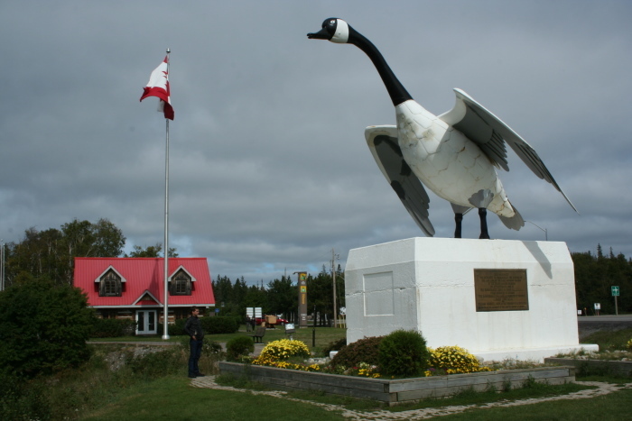
Passing through Canada’s towns and villages is important because serendiculous sights and encounters demand further examination. Each of them is potentially rich with opportunities to overcome our virtual social media isolation with literal face-to-face interactions. It is an excellent way to meet and get to know our long-time neighbor, another reason for this journey. (Do you know the names of your next door neighbors? How about their last name? And when was the last time you talked with them?)

Having visited this northern nation several times over the past 30 years, traveling there is not completely unknown. But anticipating two totally immersive weeks in a countryside and culture burns with an ember of anxiety that is both frightening and exciting. One must never forget that this is a separate nation.

Preparation is the antidote for anxiety. Conversations with my insurance agent, bank, and credit card and cell phone providers have illuminated the dark corners and revealed nothing scary. Passport in hand, crossing the border on my way north should not pose a problem. I know how many cigars I can bring with me and I’ve never had or been charged with a DUI, an offense that will deny admission.

During my journey I plan to enjoy my first Cuban cigar, because are legally sold in Canada. I’m curious to know if they are really that good or their reputation is built on America’s prohibition of them. Perhaps not without reason, given America’s political climate, I’m more concerned about turning south for home. Regardless of which way a traveler is headed, crossing the border is at the discretion of the personnel at each checkpoint.

Uniting the reasons why I’m eagerly anticipating this journey is a 2008 Canadian film, One Week. Its protagonist, Ben Tyler, is a high school teacher of English whose first novel was rejected. In the film’s opening sequence a doctor delivers a diagnosis of some quickly growing nth-stage cancer with a 10-percent chance of survival. At several points he asks, “If you had one week to live, how would you spend it?”

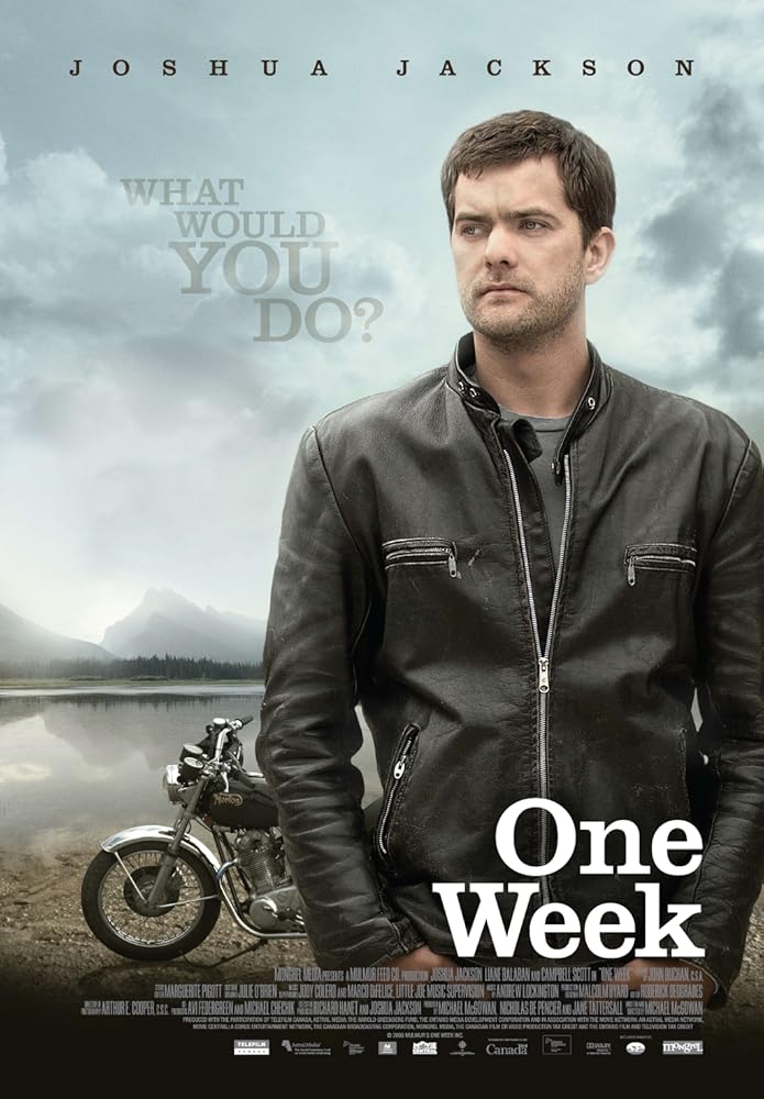
Instead of immediately pursuing treatment he postpones his impending wedding, buys a motorcycle, a Norton Commando, and sets out on a journey from Toronto to Tofino, an island that is the western terminus of the TransCanada Highway. His goal? To make memories that give what’s left of his life value beyond its prosaic routine.

The immense and diverse landscape is an important, albeit tacit, character in the film, and I can’t wait to meet it. Except for Tofino; reaching it entails a 2-hour ferry ride, and the wedding of Ed’s daughter in Massachusetts is behind our unmissable arrival deadline. But that, too, is an opportunity for Shunpike Tofino to explore that part of North America.

Standing at the doorstep of my dotage, the roster of my friends and acquaintances enduring medical maladies that require bypasses and replacements grows almost daily. Surely, one day, my name will make that list. Until then, continuing my quest for new nouns—persons, places, and things—is the best investment of the time that remains before my expiration date. In that regard, maybe I am like Ben Tyler.

Posted in Uncategorized | Tagged , , | Leave a comment

A Shunpiker’s Guide for Serendiculous Enjoyment

Sometimes a single word is all it takes to focus a fuzzy philosophy and make its underlying principles logically clear. Finding that word is the challenge. Some search for it their entire lives. I found mine on my way to confirming the spelling and meaning of another word I cannot now remember. May I introduce you to: Shun*pike n. a secondary road used to avoid turnpikes and expressways – shun’pik’er n. shun’pik’ing n.

Avoiding the traffic, tolls, texting drivers that crowd turnpikes, expressways, and Interstates is one benefit of shunpiking. Another is that secondary roads, state and county roads (many of them former U.S. Highways superseded by four-lane replacements) are the two-lane connections that unite small towns like a string of pearls.

But following a shunpiker’s path doesn’t lead to rewarding serendiculous surprises without the proper mindset. Most important is being open to collaborative whimsy that leads to the creation of words such as “serendiculous.” It was born in a postprandial search for the words that succinctly summarized that day’s rewarding and unexpected Route 66 revelations and interactions.

Perhaps the Tullamore Dew my riding buddy Ed and I were sipping as we sat outside our motel room helped us fuse these two words into one:

Ser*en*dip*ity n. [coined c. 1754 by Horace Walpole after The three Princes o Serendip (i.e. Sri Lanka) a fairytale in which the princes make such discoveries] 1 a seeming gift for finding something good accidentally 2 luck, or good fortune in finding something good accidentally. And Ri*dicu*lous adj. deserving ridicule.

For our purposes, the definition of the root word, especially its archaic use, best serves the intent of our conjoined word: Ridi*cule n. [Fr ridiculum, a jest, laughable (thing), neut. Of ridiculus, laughable, comical] 1 a) the act of making someone or something the object of scornful laughter by joking, mocking, etc; derision b) words or actions intended to provide such laughter 2 (Archaic) a) an absurdity b) foolishness.

Contemplating our many serendiculous encounters on my solo trip east from the Pacific Northwest, what united their diversity is that we became more receptive to them by shunning quotidian decision making. During this thousand-mile think four catalysts for serendiculousity took shape, and exercising them returned immediate results.

Day24-25

When in Doubt, Top the Tank

There are physical and emotional aspects to this one. Riding out of Bend, Oregon, a small blue sign that said “Next Gas 99 Miles” reinforced the former. Naturally, this sign was stuck alongside the road about 10 miles past Bend’s last fuel stop on this road. (This must be a requirement of the association of sadistic sign planters.) My mistake was not turning around and topping the tank. Instead of enjoying the scenery and looking for interesting turnoff to explore, I obsessed on the fuel gauge and was blind to the passing landscape.

Two days later, passing eastbound through Shoshoni, Wyoming, on US 26, I thought about getting gas and decided that I had more than a hundred miles left in the tank and more than a few fuel stops in that distance. But it had been a long, quiet morning on the road, and I needed to fill my emotional tank by talking to someone, even if it was the clerk at a gas station, so I U-turned for the gas station.

As I was cleaning the bugs off my visor, two Harleys rumbled up to the other side of the pump. We nodded a greeting to each other, as those related by two wheels often do, and then I started a conversation. As a card-carrying introvert, this is something I seldom do, but I’ve been taking lessons from extroverted Ed, because observers rarely participate in serendiculous adventures.

Aside from the tattoos and leather, we were peers beyond two wheels. Bear lived in Minnesota, and “I had long hair,” he said, showing its length with a hand held in the small of his back. Discharged from the Navy in 1977 (a year before I got out), “I promised myself that I’d be a hippy ‘til I’m 50,” and on that birthday he started shaving his head.

Mark was from Montana. He met Bear in the engineering department of a submarine tender. After getting out of the Navy in 1978, he and Bear reunited for a road trip to a friend’s wedding. They had so much fun they vowed to do it again every year, and 35 years later, they actually made it happen.

Our meeting in Shoshoni was their third trip, and unlike and I, who make solo rides east and west, Bear and Mark meet somewhere in the middle then decide where to wander. The more extroverted of the pair, Bear said, “I have nine days and a credit card that says I can go wherever the hell I want.”

Day22-3

For the Big Picture, Look at a Paper Map

Zumo excels at GPS navigation and suggesting where to refuel and rest for the night, but when following a shunpiker’s path, it can ask more questions than it answers. There’s never been a question that Zumo will not lead me to my desired destination. But there are questions of the algorithmic routes that will get me there. To avoid this distraction, I rely on the cartographers who craft old school paper maps, which I collect from every state I visit.

Maybe one of these days digital maps will incorporate the dotted lines that indicate that the road they parallel is a scenic byway. It would make planning a route for Zumo on my laptop easier, but it still wouldn’t be as much fun as discovering all of the serendiculous opportunities scattered along the way.

That’s how I found the Old McKenzie Road, which took me past the Goodpasture Bridge (above), and the McKenzie Pass-Santiam Pass Scenic Byway, which snakes for 82 miles through the Cascade Mountains in Central, Oregon. It took me almost four hours to cover this distance, most of it in second and third gear. Yeah, it’s a biker’s twisty dream; there are sections where 30-footers are prohibited. If you’re heading east in late summer, don’t leave early because the rising sun makes it hard to see. Fortunately, there wasn’t much oncoming traffic on the excellent road.

Had I not followed the dotted lines on the paper map I would have missed a first-hand geography lesson at the Dee Wright Observatory (which I’ll share in a dedicated story) that introduced me to the Three Sisters.

Day8-95

Plan Time for Exploration

With so many small towns to visit, and with so little time left in life, it became clear as Ed and I recollected out penultimate adventure that we’d spent too many days in the saddle. As we discussed our overnight stops with friends in his backyard redoubt overlooking the lake, we concluded that limiting our daily travel to 300 miles didn’t always leave us enough time to explore. Some places deserved a second night so we’d have a full day to poke around in search of serendiculous encounters. (A day of butt rest would be nice, too!)

Williams, Arizona, would have been an excellent candidate for an extra day. My stroll up and down the main drag after dinner inflamed my curiosity, and the late hour (and the need to visit the Laundromat) didn’t allow time to satisfy it. On October 13, 1984, it became the last Route 66 city bypassed by Interstate 40.

Day13-28

Take a Hint, Act on Impulse

Another town worth a day of exploration is Gualala, California, and finding it was a defining moment of serendiculousness. We were riding up the coast from San Francisco, enjoying the ocean view. And with some regularity we passed signs that pointed to a “Scenic Overlook” that required a perpendicular turn to the left or right. After passing a dozen or so such signs, I finally took the hint and suggested that we turn off at the next opportunity. The photo above does not do the vista justice. If you look close, you’ll see kayakers on the Gualala River. If we spent the day, I could have joined them.

All of these are lessons learned that will forever influence my shunpike journeys. More than rules, they are guidelines that all say the same thing, to listen to that little voice between my ears when it whispers, “Hey, that looks interesting!”

Posted in Community, Guidelines, Main Street, Motorcycle | Tagged , , | 1 Comment

A Water Tower Oasis in Arid Ash Fork, Arizona

Day9-4Following Route 66 west across the barren, baked brown Arizona landscape in the early morning oven of August 8, 2016, Ed and I were looking forward to nearly a hundred miles of the original two-lane Mother Road just past Ash Fork. Slowing down at the city limit, a brightly painted sheet of sedimentary rock welcomed us to “The Flagstone Capital of the World.”

And then, oddly, the two-lane diverged into separate one-way streets. Normally, the two-lane pierces the heart of a small town’s business district. From Lewis Ave., Ash Fork didn’t seem to have a commercial district. And snatched glances to the south revealed only a couple of businesses on the opposite one-way, Park Ave.

What brought me to a stop was a water tower. On four steel-latticed legs, it stands outside Lewis’s left-reaching arc that reunites it with its eastbound sister. Unlike other water towers that name the small towns they serve, this one bore a blue tattoo on its silver skin, halfway down from its conical cap. Why does it wear the logo of the Santa Fe Railroad?

Hoping for an answer, I dismounted next to the Ash Fork Centennial Park. A chain link fence surrounded the triangular gravel bed with several large rocks, two concrete picnic tables, and a single green tree. Just past the fence was a small brown shed that stood between its roadside legs.

A standpipe extended above the shed. It anchored a long white, 4-inch thick corrugated plastic trunk. Beside it was an alcove that sheltered the pump’s controls and digital read out. A sign with a ghosted photo background of a water tank emblazoned with ASH FORK 1882 said nothing about Santa Fe, but the words emphasized its message with capitals and colors and creative punctuation.

ASH FORK WATER SERVICE Provides & Maintains this Standpipe for filling

“POTABLE WATER TANKS ONLY”

~NO EXCEPTIONS~

Anyone who uses this facility to fill a NON-Potable water tank Could face charges of “Contamination of Public Water Supply”

Account Holder of record are the ONLY Authorized users of this facility.

After giving the phone number for reporting violations of this policy, it said:

*This Water meets all Drinking Water Standards*

Finally, after warning against “flushing or addition of any ingredients into your tank,” it defined “Potable Water Tank – a tank that hauls drinking water, as it’s only intended use, and, the water is immediately ready for Human consumption.”

Day9-6

While reading this, a middle-aged woman wearing a long florescent pink t-shirt parked in a gravel lot behind the tower and started unloading a station wagon load of gallon jugs, their milky translucent skins spotted with dark blemishes earned by long use. Around the corner from the standpipe and sign, I discovered a vending machine that dispensed “Drinking Water 25¢.”

Clearly aware of each other, our silent gazes never connected. Her undistractible and efficient feeding of quarters and jugs into the machine, and loading the full container into her car while the next one filled suggested that this was not an unusual errand, or the only one on this day’s to-do list. Or maybe she didn’t want to acknowledge the presence of a hulk in boots and a heavy jacket, working a camera and notebook.

Pulling on my Midwestern roots, you filled water jugs in times of emergency, when a main artery broke or something contaminated its supply. Having to fetch water to meet your daily needs, to cook, to drink when thirsty, to brush your teeth, never really dawned on me. But the tower’s sign and vending machine, and the woman’s clearly practiced effort, suggested that this was part of daily life in arid Arizona.

Day9-5Regardless of its history, Ash Fork was clearly an oasis in a baked land. Later I learned that it had no source of water until the town sunk its first well in 1975, drilling nearly 1,000 feet before they hit water. (It drilled a second well later.) Before that, a daily train delivered drinking water from Del Rio Springs, 33 miles to the south, in Chino Valley.

Built as a siding for the Atlantic and Pacific Railroad (predecessor of the Santa Fe), this community of 396 people (as counted in 2010) has burned three times since its founding in 1882. After the first fire in 1893, its citizens rebuilt the town on the other side of the tracks, where it stands today. The next conflagration, known as the Big Fire, destroyed what remained of the businesses district November 1977.

The Mother Road herself decimated the community in the 1950s when the road commission bifurcated Route 66 as it crossed the city limit. Construction of the divided single-tracks destroyed downtown storefronts, sidewalks, and residential streets. Then Interstate 40 bypassed the community when it replaced Route 66, diverting the businesses’s life-giving customers.

In 1960, the Santa Fe moved its east-west tracks north. As most residents worked for the railroad, Ash Fork’s population fell by half. The flagstone quarries are now the primary employers, followed by the school district. The last major fire claimed a few of the survivors in the two-block business district in October 1987.

Ash Fork must have been something before that. With a north-south rail line crossing the Santa Fe’s east-west line, it was a busy railroad junction. Harvey House built the Hotel Escalante there in 1907. Uniting concrete and steel in the Mission Style, its 420-by-200-foot footprint encompassed the hotel, a dining room, a lunch counter, and gift shop. It closed in 1948, and they razed it in the 1970s.

But as an oasis, a source of water for the hardy residents in and around the town, Ash Fork will continue. A 2005 article in the Arizona Republic said, “Hauling Water is a Way of Rural Life,” emphasizing its importance beyond the woman with her jugs and pocket full of quarters. “The water-filling station in Ash Fork, a tiny town west of Williams in northern Yavapai County, draws lines of trucks all day long on weekends. The town is served by a small water system, but most residents beyond a square mile or so must haul water or have it hauled in.”

Day9-7Better than those who reside in greener parts of the ration, those who live in and around Ash Fork know that their future well-being depends on the aquifers that sustain them. According to a 2014 report, Ash Fork Water Manager Lewis Hume wrote that the community depends solely on ground water wells, and it is not abusing its aquifer contained by Tapeats Sandstone and Martin Limestone.

“Static water level [measured in feet below the surface] is a good indicator of aquifer condition,” wrote Hume. “All measurements from 1996 to present have shown static water levels in the 998’ to 999’ level. Our most recent measurement on 5/2013 showed a level of 999.2’ Aquifer recharge is equal to or greater than its demand or use. In comparison, water level declines in the Flagstaff region are as much as 200 feet in areas affected by ground water pumping.”

The report said the water service dispensed 45 million gallons (MG) in 2007 and 2008. It pumped 35 MG in 2013 and anticipated 37 MG in 2014. That’s a lot a one-gallon jugs. As Ed and I continued west, the woman in the florescent pink t-shirt was filling the last of hers.

Posted in Community, Main Street, Motorcycle | Tagged , , , | Leave a comment